
A new lab study mapping genetic diversity across landscapes, and demonstrating it influences forest damage (and likely mortality) – read it at Global Change Biology or download a PDF. Our spatial map of genetic features can be interactively explored (very fun!) using Google Earth Engine.

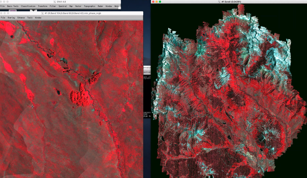
Species distribution models typically assume that distributions depend on the environment only, when in reality there may be a complex spatial mosaic of genetic variation that could influence patterns. Mapping these landscape genetic patterns is traditionally very challenging because of the need to do genomic analyses over spatial grids. Our new study shows that in quaking aspen, a foundation species in North America, (1) intraspecific genetic diversity [cytotype] can be mapped at 1 m resolution using hyperspectral imagery, and (2) cytotype-environment interactions in turn predict canopy damage and mortality.

Our remote sensing analyses came from NEON Airborne Observation Platform data collected in 2018 over southwestern Colorado, analyzed by co-authors Phil Brodrick, Dana Chadwick, and many others.

The imagery was combined with ground-based genomic and demographic data we also collected in several hundred locations in the same region.

Using these data we were able to map cytotype (diploid vs triploid, n=2 vs. n=3 copies of each chromosome) across the landscape, unveiling complex and intriguing patterns of genetic diversity.

We then combined these data with canopy damage data and environmental data to build models showing that damage depended strongly on cytotype-environment interactions. In particular, we showed triploids were at higher risk in hot and dry environments.

Please check out the study – we think it provides an intriguing starting point for integrating remote sensing and genomics in more species and contexts.