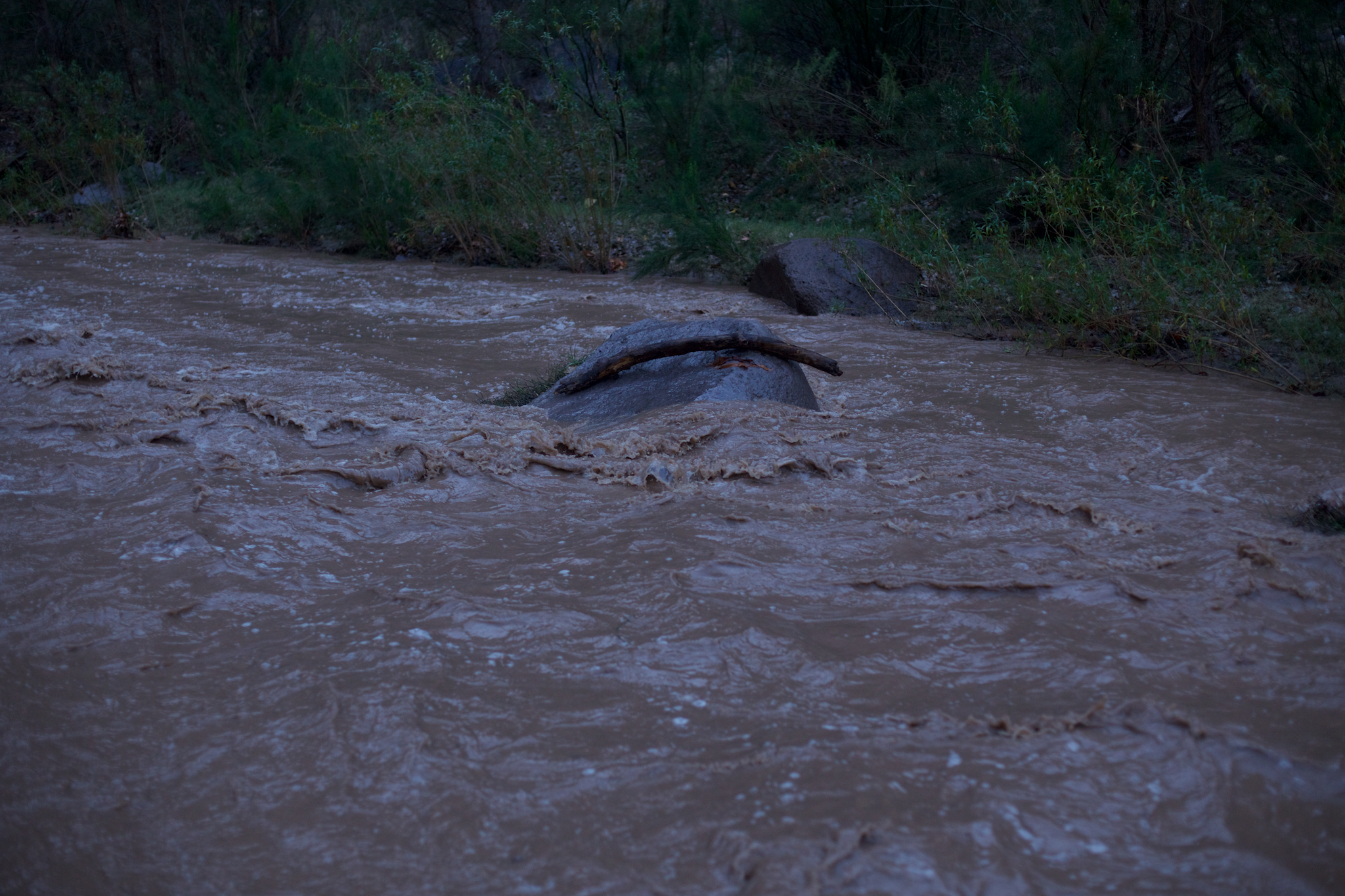
Flowing water is a rare feature in the canyons of the American southwest. The few that do have it are magical and dynamic places. Aravaipa Canyon is one of them – fifteen miles long, a few hundred feet deep, with narrow walls. It drains an area with complex geology, yielding a permanent stream that brings life to the canyon bottom.
The water is usually not very deep, or very fast – just a few inches deep in most places, and clear-running – a silvery ribbon through the desert.
But there is also evidence for higher flow rates in the canyon. Sharp undercutting of cobble beds occurs, leaving precipitous edges.
Sometimes this erosion causes desert cacti to plunge to their deaths.
And in other places, leaves and sticks can be found trapped in branches or rock-cracks, clearly left behind by past flooding.
But most of the time, the canyon is a peaceful place, with just a small trickle of water. That was how it was when I went to re-explore it over the new year – a backpack homecoming to Arizona, of a sort.
A pleasant day was spent walking several miles in, splashing around in the water, botanizing at its edges, and setting up a tent on its edge. But sometimes it rains – and on this trip it did, late that same evening. In Arizona, rain is usually very predictable – either none (most of the time), a heavy and rapid summer thunderstorm (only the summer), or a long drawn-out heavy rain (only the winter). In this case, the forecast turned out to be incongruous with reality, and the summer and winter mixed to produce a long drawn-out heavy thunderstorm.
There are three important things about being in a canyon in a storm. First, it’s hard to know when one is coming, or going – with steep stone walls, only a very small angle of sky is ever visible. Second, even if it is not raining where you are, it might be raining upstream, where you can’t see the clouds. And third, all the rain that happens further up in the watershed eventually has to drain out through where you are.
The net effect was that by two or three o’clock in the morning, our peaceful stream rose up to a depth of perhaps two meters (judging by throwing in rocks and probing with poles), went from clear to an angry deep brown, and was running fast – carrying logs on the surface, and occasionally tumbling a large rock under the water’s surface, producing an erratic and unnerving deep clanking sound that built on the rushing of the water over boulders.
In short, there was no way out – no ready path up to the canyon rim and out, and the stream was too fast and deep to be crossable, especially knowing that there were bedrock-scoured pinch points further downstream, and plenty of large debris to trap someone swimming the rapids.

And so something of a waiting game began – the continuing heavy rain, against the absorption of water by the watershed, and the flow capacity of the stream, against a dwindling supply of food reserves. But being there was a beautiful opportunity to see how dynamic of a place a canyon in flood can be.
In many canyons, the vertical side walls often have a black colored where it looks like water might sometimes seep out. I found out that most of these turn into large waterfalls when there is enough rain – and they are beautiful. And sometimes soils destabilize and large boulders come flying down from high canyon walls – less beautiful, and somewhat scarier.
What else is there to say? The rain continued for two long, cold, and hungry days, and it looked like the waiting game was a losing proposition. On the third day, the stream finally dropped to below hip depth, though still running dark brown with rapids. It was time to make an escape, and several hours, dozens of crossings, and no photographs later, I was on dry ground again – a lucky exit from an unlucky situation.
The United States Geological Survey monitors streamflow across the country, and as soon as I got back to a computer I went to have a look at the data for Aravaipa Creek. They showed that this event was actually not a very large one relative to the average, and that the speed of flooding and the return to normal conditions were also typical.
I have plotted up some of these data here, in blue (annual average flow in green). You can see that the flow rate increased by a factor of ten in less than an hour, then spiked several times as storms passed over the watershed, then took several days to come back down. The red line is the flow rate at the time I decided it was safe to get back out – glad to not have made an attempt on the first day of flooding!
The canyon bed is full of rushes and grasses and small trees that can bend in the floodwaters, stay underwater, or perhaps even rely on the floods to complete their life cycles. Biologists, on the other hand, have no adaptations to these conditions other than patience and good weather forecasts. I will keep these memories, and hope to leave even average-sized future floods to the year-round inhabitants of Aravaipa Canyon.


